Staying ahead of virus outbreaks with GIS Maps
Virus transmitting mosquitos can breed in a teaspoon of standing water. Data-rich maps and GIS software allow countries to stay one step ahead.
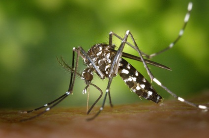
For county-level vector control officials, staying vigilant against viruses and the invasive species that transmit it - namely mosquitos, comes with specific challenges.
Some types of mosquitos are urban dwellers. They live among people and thrive in the tiniest amounts of stagnant water which makes them extremely dangerous if they are virus carrying mosquitos.
An outbreak can breed within a teaspoon of water. Mosquitos even have the ability to spawn in a vessel as small as a beer bottle cap.
Pretty much every house has some standing water in pots or tarps.
Many local governments, particularly in the rural and provincial areas, still lack vector control departments and remain shockingly unprepared for a potential virus outbreak.
On the other hand, many governments around the Philippines and the world have been investing in ways to make their operations more agile and with help from GIS companies, they are embracing technologies that can make even the smallest vector control department able to nimbly tackle these thorny problems.
Making the Complex, Routine
Staying ahead of mosquito populations, and the risk of a virus, can at times require some creativity.
Most viruses inevitably have the highest chance of being transmitted from someone who has traveled from the virus-affected areas.
The process of monitoring mosquitoes is an exercise in making the complex, routine.
The mosquito species is very well-established in the Philippines and across the world.
Countries with mosquitos that carry viruses and diseases should have a system put in place. There is a particular need for inspectors responsible for vector control monitoring, monitoring of trap sites and known breeding sites, along with the tackling of mosquito-related citizen complaints.
This operation would be made much simpler with GIS mapping technology.
Every time an inspector visits a trap—which they locate with the help of geotagged stored and saved information —they record the data from the trap from the field and automatically sync that information with highly detailed interactive maps.
Once the analysis of mosquitos found in traps comes back from the lab, that information too is added to the maps.
'The Data Is the Currency'
The work of the vector control team should all be about surveillance. That means laying traps in vulnerable locations, monitoring the mosquitos in those traps and then analyzing the information they collect.Vector control officials can use a GIS app to record trap locations, measure areas, and upload information—all in real-time—to readily accessible data-rich maps. The data is basically the currency. It’s really just environmental monitoring, but when you add years of data, you can start to predict when mosquitoes will breed, and you can send people out in advance.
Information collected on local mosquitos is not yet available to the public. Detecting Aedes aegypti mosquitos would likely be the catalyst that would change that.
In the event that mosquitos that can transmit Viruses and diseases do spread to new and more densely populated areas of the Philippines it would be helpful for the public to be able to look at these maps and do their own vector control work. After all, with these invasive species able to breed in the smallest amounts of standing water, every citizen would need to pitch in to keep populations under control.
Emphasizing Vector Control Beyond the Disease of the Moment
GIS tools have made all this possible.
Iterations of this technology used to be out of the price range of most citizens and organizations. However, new GIS apps has brought smart mapping within their reach in a big new way.
New vector control-specific templates with GIS apps is creating excitement. Templates that assist with planning for adulticide operations, mosquito larvicide reporting, citizen mosquito service requests and more.
This is a long term issue which requires long-term solutions. Zika is the newest mosquito carried virus, but who knows what mosquito-borne disease will come next.
A long-term approach means having a robust vector control operation in place, regardless of which disease is on the horizon.
A long-term approach also means “balancing mitigation versus environmental stewardship.” Accessible data makes keeping an eye on sustainability and ecological protection all the more possible. For example, many counties are using GIS to map known bee colonies, so when anti-mosquito fogging must take place, those vulnerable pollinator populations may be avoided.
Vector control isn’t just important because of Zika. A robust vector control strategy should be a focus for every country, regardless of the mosquito virus.